Geostruct’s Infra Management Suite (IMS) is a state-of-the art software solution based on an extremely flexible data model that enables the configuration of virtually any existing or future network.
The fully integrated database and GIS and CAD functionality make Infra Management Suite a very powerful tool, capable of underscoring all aspects of network design and support, in a user-friendly and effective way.
Optimise network planning and management
Efficient tooling for all steps of your building process
Infra Management Suite
We believe that ideally, one database should support the complete end-to-end network planning process. This should be facilitated by easy-to-use interfaces for data input and retrieval. Our IMS offers exactly that.
It combines InfraManager for setting up models and reporting for all network configuration types, the InfraMap GIS and mapping solution, a host of practical, integrated mobile applications and a wide range of services.
Let’s take a closer look at all of the IMS components…
Solution
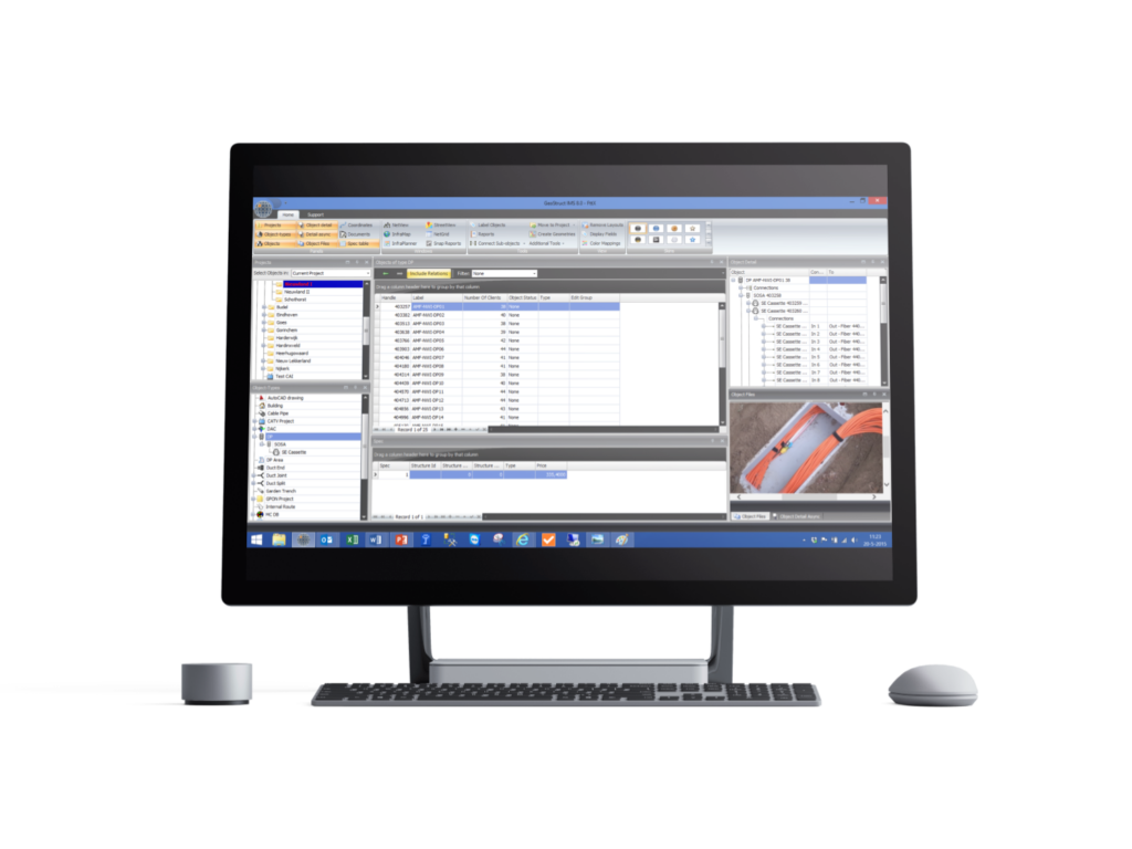
InfraManager is the core of the Geostruct IMS. It provides all functionality for setting up network models and reports and gives a comprehensive database view on networks in every stage by providing:
Infra Management Suite is a particularly powerful tool, that supports network design and support in a user-friendly, effective way.
Solution
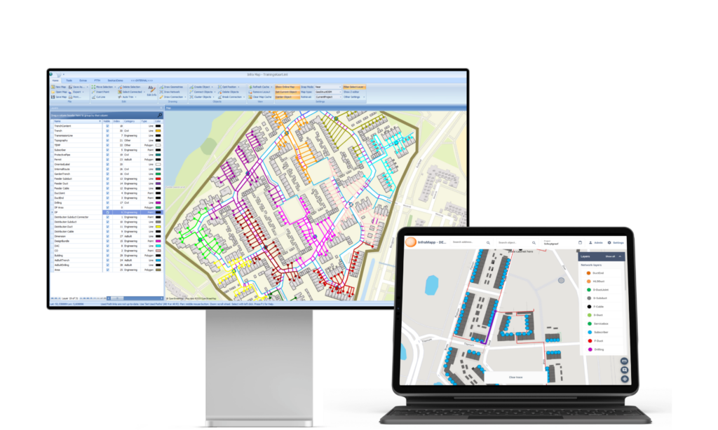
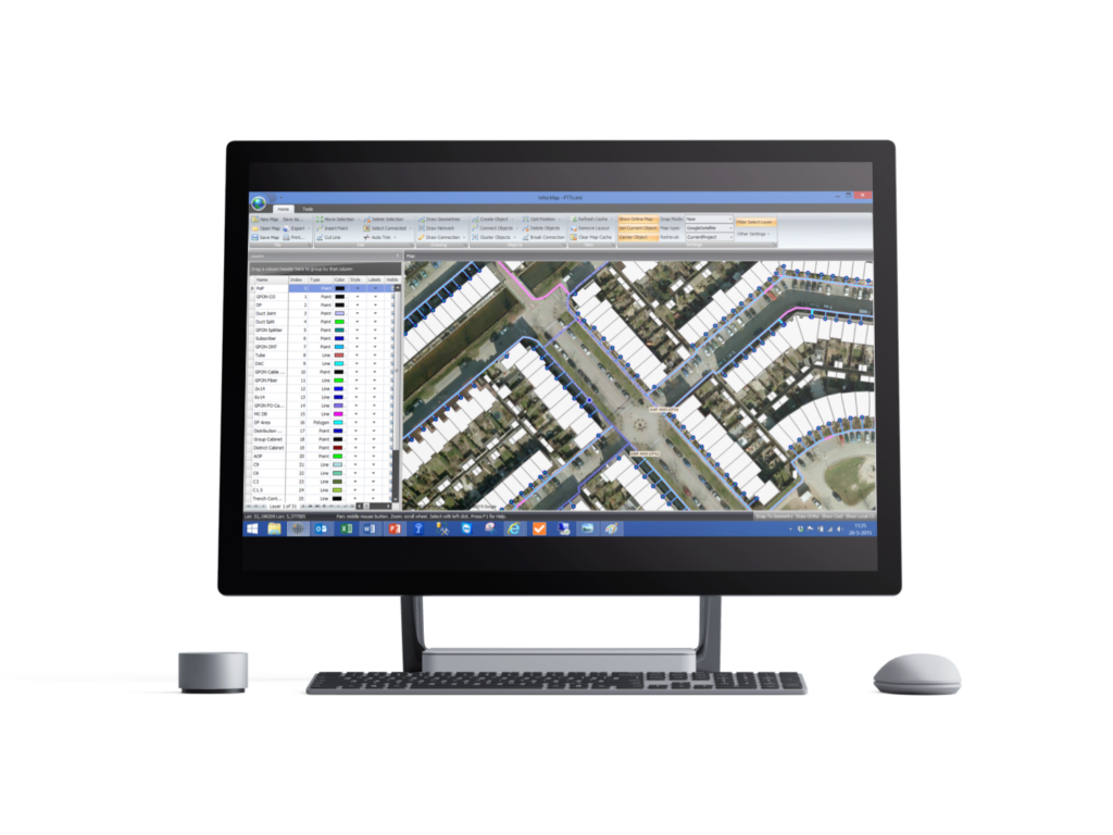
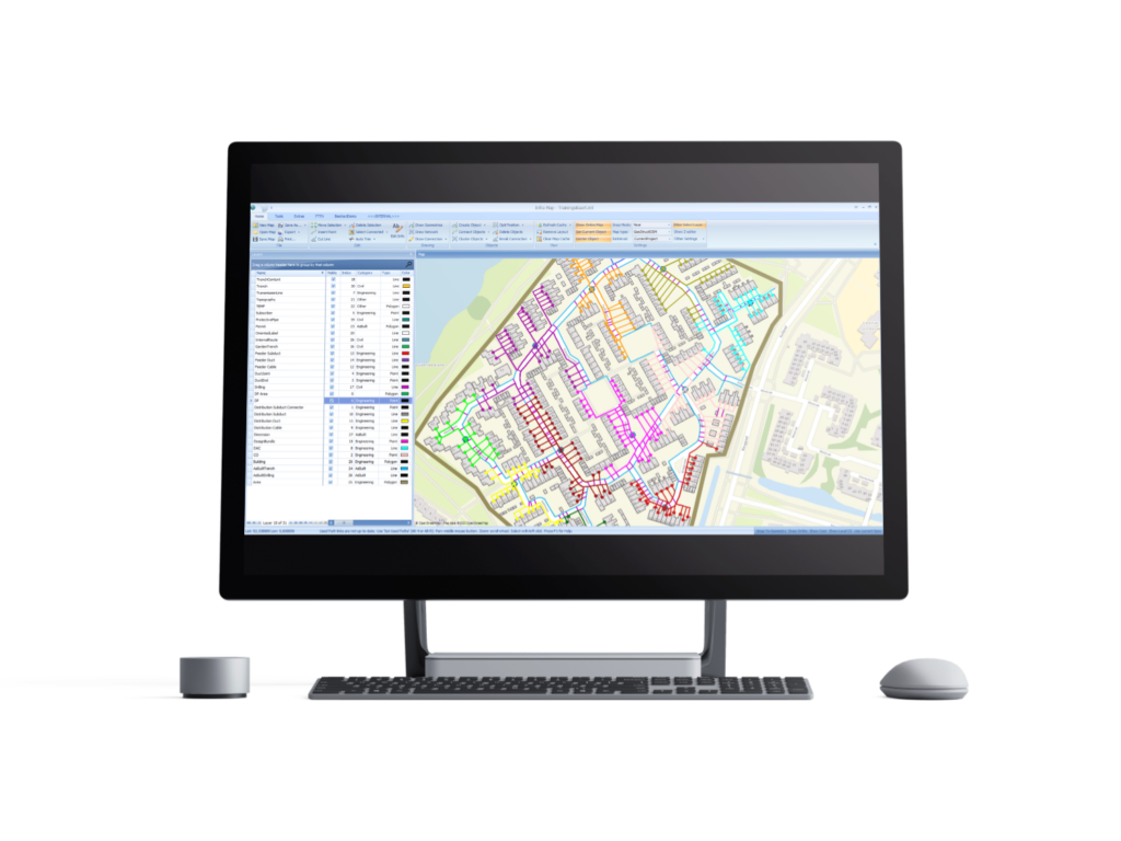
InfraMap is the GIS and mapping solution in Geostruct IMS. The specific design, drawing and analysis functions provide the ideal tooling for efficient network design and management.
Solution
This is our built-in mathematical cost-optimisation engine. Based on heuristic and short-path algorithms, AutoCluster finds the optimal allocation of nodes, cable routes and the locations of related distribution points for any level in a network. It does all this by:
Solution
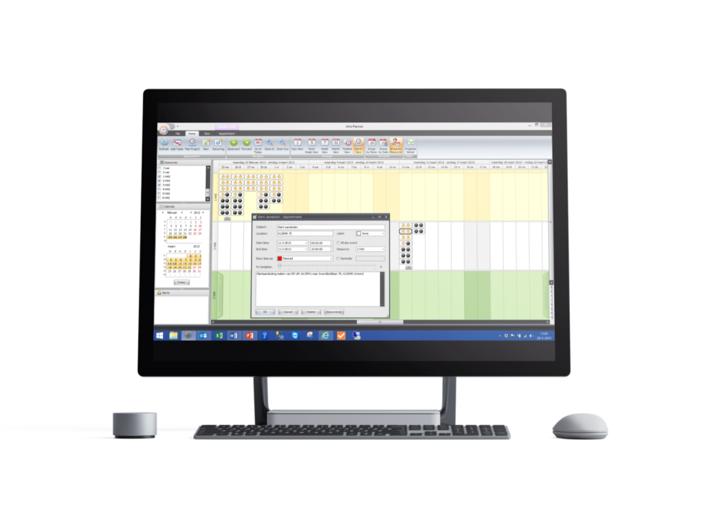
InfraPlanner is a comprehensive, easy-to-use, resource planning tool that is fully synchronised with InfraManager, InfraMap and GeoWorks. InfraPlanner enables and facilitates:
Solution
Network management provides easy access to and control over all data stored in the network and helps to:
An effective, user-friendly solution for in-the-field surveys, data acquisition, redlining and analyses.
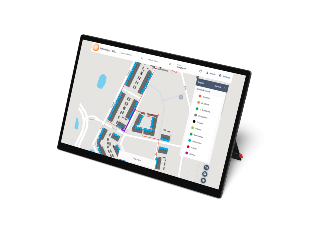
InfraMapp is a field module used by field workers to point out layers in the design.
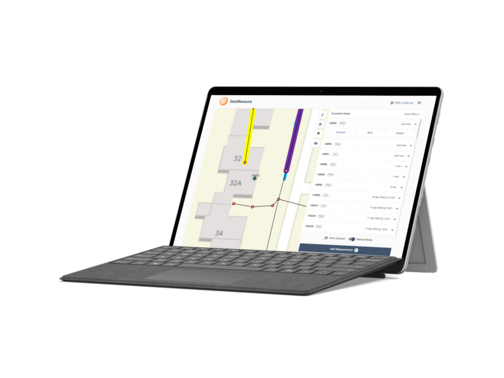
GeoMeasure supports accurate in-the-field GPS measurements and built-data collection.
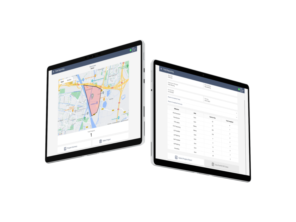
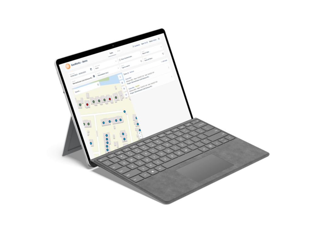
FRT is a project management tool that provides status overviews of simultaneous projects.
Infra Management Suite is a particularly powerful tool, that supports network design and support in a user-friendly, effective way.
Winthontlaan 200
3526 KV Utrecht
The Netherlands
Phone: + 31 (0)30 – 750 8945
Email: sales@geostruct.com